
Welcome to Landsat Lens, a touch and mouse friendly application for browsing past and present Landsat satellite imagery hosted by Esri.
Using a mouse, a lens can be moved around the map with a standard left mouse click and drag operation. Scrolling the mouse wheel will enlarge or decrease the size of a lens depending on the direction.
With a touch device like an iPad, a lens can moved with an intuitive press and drag. To resize, pinch or expand two or more fingers within a lens. Likewise, rotating a lens is achieved by twisting two or more fingers. Unlike with a mouse, touch screens allow the user to manipulate two or more lenses concurrently.
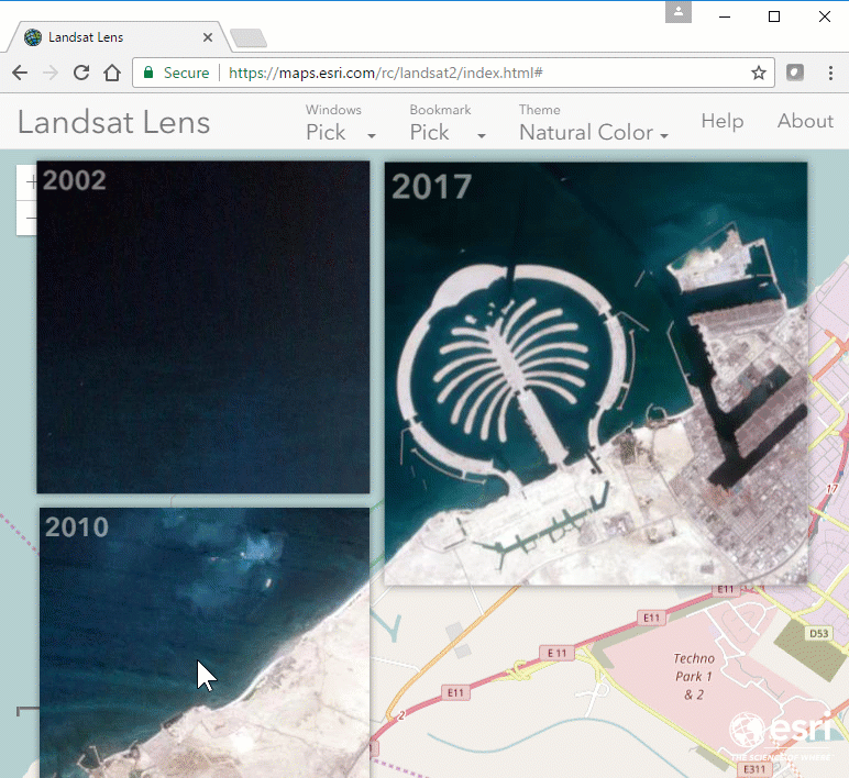
By default, the app starts with a lens dated 2017 located close to the Palm Jebel Ali in Dubai. To pick a preset location choose from one of the entries from the Bookmarks dropdown menu. Alternative you can pan or zoom to any area of interest.
For one of the preset locations, or your own area of interest, you may want to view changes over time. To do so, use the Windows dropdown menu to add a window showing 2002, 2005, 2010, 2015 or 2017 imagery. By swiping lenses over the basemap and one another you can easily see changes in vegetation, coastlines, rivers and human activity. Use the last option in the dropdown menu to removal all lenses from the map.
To display this dialog again click the help button in the upper right hand corner of the application. The About dialog details the technology used to build this application and links to learn more about the imagery.
Please visit our blog or web portal for more information on this and other applications.
![]()
This application was designed and developed by Esri's Applications Prototype Lab in Redlands, California.
The source code is available here.
The application was built using the following technologies:
Credit must also be given Yannick Albert whose jQuery Touch libary was a useful reference.
The USGS's Landsat program has been imaging the Earth for the past 45 years (see wiki). Click here, here and here to learn more about the Landsat imagery hosted by Esri and specifically the recently announced Landsat Explorer app.
Basemap: © OpenStreetMap contributors, CC-BY-SA